Thursday, 12 April 2012

Routeburn Track Days 2 and 3

Day 2
In the early morning the children are up and rushing around and talking about going for a swim in the waterfalls above the hut. Unfortunately Debbie has woken up with a cold and we make a rather more leisurely start to the day. After our breakfast of instant porridge we are ready for day 2.
Ready for Day 2

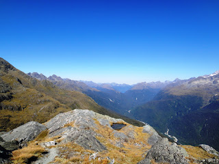
Today’s walk is all above the bush line and the track climbs away from the hut and into the open, tussocky and rocky scenery of our evening walk.
Rocks in the Valley


A steep climb brings us alongside Lake Harris, which empties itself at one end via a small stream into the valley below.
Debbie at Lake Harris

Beyond the lake we reach Harris Saddle, which is the highest point of the walk at 1225m. Here there is a small shelter and the option of a short steep side walk to the top of Conical Hill, for wider views of the Darren Mountains and perhaps a glimpse of the Tasman Sea in the distance to the west. Debbie is not feeling so good with her cold, so she takes a rest at the shelter while I leave my pack there and trot up to the top. At the top I meet a nice Israeli man, who is trying to take a self-portrait with his camera, so I offer to take it for him and then he returns the favour. In the style of relating an oft-repeated tale he tells me he grew up in north London and when he was 10 his parents divorced and his mother moved to Israel taking him with her ‘as hand luggage’.
Views from Conical Hill


Back at the shelter Debbie and I have lunch and then set off for the afternoon’s walk. Initially we go quite steeply downhill and pass several groups coming the opposite way, who are looking quite red-faced from the climb in the heat of the sun. On the other hand we are rested and also going downhill, so we pass on encouragement, knowing that later on we might be glad of some motivation ourselves: ‘Only 10 minutes to the saddle’.
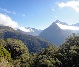
The path then sidles along a contour on the side of a mountain, with wide views across the Hollyford Valley below us to the snow-capped Darren Mountains on the other side. We are in the full sun here and the path is edged with a variety of alpine plants, so that it feels as if we are walking through a garden.
Path through an Alpine Garden

Towards the end of the afternoon the path turns a corner up th side of another valley and we stop for a rest atop a huge rocky outcrop and look down to Lake Mckenzie far below us. We can just make out the hut at the right end of the lake, which is where we are headed for tonight.
Looking Down to Lake McKenzie Hut


From where we are sitting the mountain looks almost sheer below us and we wonder how we will get down there, but in fact although it starts fairly steeply it then zigzags more gently down the mountain. Halfway down there is a plaque attached to a rock dedicated to two 13 year-olds who died here in a storm in 1963. We spend a while doing the maths to work out how old they would be now if they had lived. The path and drops into a mossy forest which is definitely home to pixies and elves and maybe also the spirits of the teenagers.
Mossy Forest

It is now only a short walk to the hut, which is another big one, this time with 50 beds. Someone has thought to reserve a long line of beds for the family of 13, so they will be sleeping together lined up like a pack of sausages. After they arrive they charge down to the lake and some of them swim, while others stand around offering the enthusiastic encouragement to get into the icy water of people who know they have no intention of going in themselves.
Lake McKenzie Hut

Lake McKenzie

Day 3
In the morning clouds hang in the valley above the lake. We start the day with a short additional walk from the hut along the lake side, walking through trees with glimpses of the lake beyond, to ‘split rock’, which is indeed an accurately descriptive name for an enormous divided boulder. Full-sized trees grow on the rock, with their twining roots attached to moss and reaching down the rock to the ground. With the aid of a torch it is possible to climb down and slither through the gap through to the daylight beyond. I go so far, but halfway through there are smaller boulders wedged in the gap above my head and it starts to feel more like a cave and cI hicken out of going right through.
Split Rock

Clouds above the Lake

When we get back to the hut to collect our packs the family is getting organised like a military operation and the small boys have to stop whittling with pocket knives; clean their teeth and find socks and boots.
Family Preparations

The walk today climbs back up to the bush line and then opens out into a grassy clearing dotted with ribbon wood trees, which looks like and is known as ‘The Orchard’.
The Orchard


The views across the valley are made more interesting by the line of clouds which hangs in the air, level with us on the path, but below the tops of the mountains.
Clouds in the Valley

After some time we come to the Earland Falls and join a group of various other trampers who are resting on the boulders enjoying the falls. The water tumbles 174m down from the top of the bare rock. There isn’t much water coming down, because it has been dry for some weeks, but the height makes it impressive and a small rainbow hovers in the spray at the bottom.
Waterfall

Waterfall Rainbow

A short distance from the falls we reach Howden Hut at the edge of Lake Howden. Several tracks converge here and some trampers take advantage of this to make a round trip by returning to near the start of the Routeburn via the Greenstone or Caples tracks and so avoid the complication of ending their walk a considerable distance by road from where they started.
Lake Howden
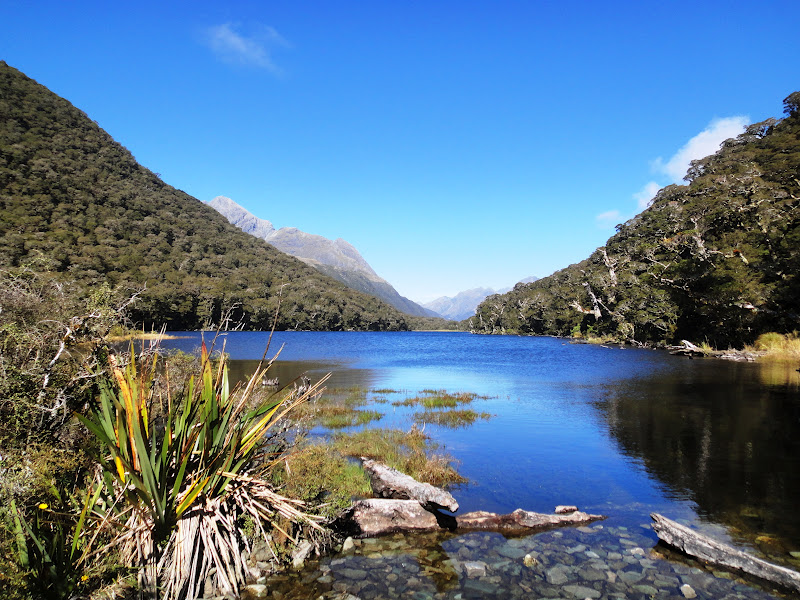
We now have the last part of the walk to complete and the track climbs quite steeply away from the lake. We leave our packs at a junction and make the optional trip to the top of Key Summit to enjoy the views.
Key Summit

Then it is steadily downhill through beech forest with the occasional sound of a vehicle driving along the road rising up from the valley below us. We arrive in the car park at the end of the track and we are grateful to see Josephine parked there waiting for us. So Debbie has successfully completed her first New Zealand tramp, while nursing a cold and her new rucksack has had its maiden voyage. I think the tramp was one of the most enjoyable I have done here so far, with varied and spectacular scenery. Thanks too to Debbie for her company along the way, and who dealt with the new experiences of life on the trail admirably. We talked about life, love and everything and also walked along quietly and thanks also for many of her pictures which I have used here.
Deb 2883 + 2885 End of the Track


Routeburn Track Day 1

The Routeburn Track is one of New Zealand’s 9 ‘Great Walks’. It traverses two national parks in the south-west of the south island – Mount Aspiring and Fiordland National Parks. This track is not an original old route for Maori, miners or loggers, but was invented by tourism, with the first visitors arriving in the 1880s. They came by horse as far as the river flats and were then guided on foot to the Harris Saddle, the highest point of the walk from the 1880s. The second half of the route was added much later.
This tramp is the main focus of the holiday Debbie and I are spending together and this is her first New Zealand tramping experience. We will be walking for 3 days and staying overnight in two huts and we are very lucky that the weather is set fair for the next 3 days.
Day 1
In the early morning we check out of our nice cosy hostel and as I walk down to admire the beautiful blue and calm of the lake, I notice a plaque in front of the building dedicated to the first residents of Kinloch in 1870. 
Bryant Family Plaque

Lake in front of the Hostel

To get to the trail head we have half an hour’s drive along a gravel road. The view looks so much as if it has come straight off the cover of a travel brochure for New Zealand that we have to stop to take a picture of the scene.  Sheep graze in green fields on the flat valley floor, with snow-capped mountains forming the backdrop.
Typically New Zealand

We are leaving Josephine parked here and we are paying a guy called Mike to drive her the 340km by road to the end of the track and then he will run back along the track. What we are taking 3 days to walk, he runs in about 3 hours! With boots laced tightly and sunscreen applied, we are ready for the walk. Debbie has a beautiful brand new rucksack for this adventure and as we haven’t got a bottle of champagne to crack over it (and anyway that would stain it), we mark the occasion by posing for this picture at the start of the track.
Starting the Routeburn Track

The track starts out flat and wide in the shade of a beech forest, with bridges crossing and re-crossing the river, before starting to climb up the valley side and then emerging into the sunshine on the flat grassland of the valley floor, where we stop for a short rest.
Bridge and Forest

River Flats
Next comes a steep climb, with glimpses of the mountains through the trees and we are soon looking back high over the valley floor where we rested.
View through the Trees

Valley View
About 4 ½ hours after setting out, we reach the hut for our first night. It is an enormous modern hut; the biggest I have stayed in so far, with 48 beds, snuggled into the trees just below the bush line and has a veranda looking out over the valley we have walked up today.
View from the Veranda
After a cup of tea and claiming our bunks the sun has already gone from the hut so we take the short walk recommended by the hut warden to scramble up the hill behind the hut, to make the most of the evening sunshine and admire the view from higher up. Immediately behind the hut the scenery is very different from what we have experienced so far today; it opens out and becomes alpine and rocky.  
Evening Walk

View from the Mountain Peak
Even up here the sun disappears early behind the mountains and by the time we return to the hut the almost-full moon has risen and seems to hang in the open space between the veranda and the mountains.
Moon

The hut has filled up with people of all nationalities and ages, and everyone is sorting out their gear, where they will sleep and cooking their evening meals. There is a group of young Singaporeans who sing together through the evening and a group of two Kiwi families with 4 adults and so many children who are never still in one place for long enough for me to count them. I find out later there are 9 children aged between 7 and 14 years old! This group arrive quite late so have no chance of getting beds together, so the children climb and swing from various top bunks to see where everyone is and clatter up and down the veranda in the dark. Fortunately, once they settle down for the night they sleep soundly.
Evening in the Hut

Sunday, 8 April 2012

Holiday with Debbie

You may remember my friend Debbie, who I met on my tour in Nepal and that I stayed with her in Hong Kong at the end of my China trip back in November. She has come to New Zealand to join me for a holiday. The main thing we are going to do is a 3 day tramp in the south west of the island. We have 3 days to drive Josephine down through the middle of the island to the start of the tramp, which is not far from Queenstown.
I pick her up from Christchurch airport and we start off with a short visit to the city centre for her to see the devastation of the fenced-off ‘red zone’ and the Re-Start container mall.
Debbie at Re-Start, Christchurch
Then we drive out of the city and stopping for a picnic lunch out of the back of Josephine, we head for Lake Tekapo, which is our first overnight stop.
Picnic Lunch
We book into the YHA hostel, which is located right on the lakefront, with a fantastic view from the lounge across the lake to the mountains. The following morning dawns bright and clear and we take the opportunity to walk along the lake-side and up to the top of a hill, with fantastic views across the lake and down to the little town. The lake is famous for its striking turquoise colour, which is a phenomenon resulting from finely ground rock being suspended in the water.
Lake Tekapo
Me (posing) at Lake Tekapo
On the bank of the lake there is a small stone-built chapel, which is situated in a most picturesque spot. This location is often chosen for wedding photographs, particularly by Asian couples, but today is not a good day for photographs because for some reason the whole contents of the chapel have been moved outside and the pews, font and organ are lined up on the grass outside the front door.
Chapel of the Good Shepherd
After our walk we set off driving further south. We cross a wide, flat, brown prairie-style landscape and stop for a beautiful view of snow-topped Mount Cook, all misty in the distance across Lake Pukaki.
Mount Cook

Next the road climbs into a pass through wild mountains covered in a velvety cloak of short brown grass.

Lindis Pass


 Then we drop down to Wanaka, a town on the edge of another beautiful lake, which is our destination tonight. We check into our hostel and then take a walk along the lake-side as the sun goes down and the pink clouds of the sunset are reflected in the water. The clocks went back 1 hour at the weekend, so it now gets dark at about 7pm.
Wanaka

Then Debbie makes a great suggestion and we sit outside a lively bar on the lake front for a beer. Can you believe this is my first beer in New Zealand! It tastes bloody marvellous.
Beer

The next day we have a fairly short drive over a high pass, with great hairpin bends, to Queenstown, again located by a lake, but if anything this town is even more picturesque than the previous 2 places. We have to stop here for the last arrangements for our tramp. We have to get our hut passes from the DOC office, visit the company which will relocate Josephine, so she will be waiting for us, as if by magic, at the end of the walk and pick up supplies for the 3 days of the walk. We like the atmosphere in Queenstown, it is lively and people are jumping off a mountain behind the town with parachutes and landing elegantly on the rugby field.
Coffee at Queenstown

Queenstown
Having completed all our arrangements we carry on driving out of Queenstown and along the lake side. We stop at a convenient lay-by to admire what I think is the most stunning view I have seen so far I New Zealand. The surrounding mountains are reflected in the glassy surface of the lake and the eye is drawn to the snowy mountain peaks in the distance. Again the photograph doesn’t really capture the whole beauty of the scene.
Lake Wakatpu
Our accommodation tonight is remotely situated quaint old wooden-built hotel and hostel at the head of Lake Wakatpu that has been here since 1868. Our tramp begins tomorrow and we are ready for it and excited.
Kinloch Lodge