Friday, 3 February 2012

Havelock and The Queen Charlotte Track

I catch an intercity bus one hour east of Nelson and arrive at the little town of Havelock, which is situated on the west of the Malborough Sounds, at the mouth of the Pelorus River. Havelock calls itself ‘The Greenshell Mussell Capital of the World’.
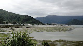
Havelock

I make a circuit of the town and find it has a pleasant waterfront with a working harbour for the mussels and a smart marina. There are several places to eat, from a takeaway to a top end café-restaurant and they all serve mussels. I decide that I should try the mussels while I am here and as I have a discount voucher from the hostel for the posh café-restaurant, that’s where I have my lunch, sitting looking out over the marina.
Havelock Marina
Mussells for Lunch

I call into the small museum and find out that there was an original Maori settlement on this site and then the European settlers came here on the back of the gold rush of the 1860s and Havelock grew up as a port to service this industry. Timber and saw mills were the main business and the museum has many mementoes of this time. One of the main sources of entertainment and recreation in the town seems to have been wood chopping and sawing competitons.
Sawmill workers of 1880

I am amused by the collection of saws displayed on the wall of the museum – it’s a family joke that Sue, Keith and Andrew will appreciate!
Saws in the museum

Havelock has two famous sons: William Pickering, whose field of expertise was jet propulsion and guided missiles. He directed the construction of the first US satellite. The second was Ernest Rutherford, who won a Nobel Prize in chemistry in 1908 with the snappy title of ‘his investigations into the disintegration of the elements and the chemistry of radioactive substances’. He was one clever dude and developed the fore-runner of the Geiger Counter and split the atom in 1918.
I look in a shop window that displays community notices and posters, to see what is going on in the town. Sadly there don't appear to be any woodchopping competitions any more. There is an advert for the Havelock Players amateur dramatic show which is currently running at the community hall. The proceeds from tonight’s performance are going to the Christchurch earthquake relief fund. There is also a poster still up from last year’s Annual Havelock Pig Hunt. It took place between 6am on Friday 17 June, with the final weigh in at 4pm on Sunday 19 June. The prize for the ‘best tusks’ is a taxidermy freeze-dried head mount valued at $1000 (about £500). The heaviest boar prize is $500 worth of jacket and trousers. There are also separate women’s and youth categories for under 15 year olds. The youth’s first prize is a hunting knife worth $200 and the women’s first prize is a voucher worth $150. Not much encouragement for the female hunters!
Annual Havelock Pig Hunt Poster

I borrow a bicycle from the hostel and cycle out along the side of the estuary to a point. There is a short walkway here which gives great views of Pelorus Sound.
Pelorus Sound
The Queen Charlotte Track is another New Zealand ‘Great Walk’ it goes through the Malborough Sounds and it finishes not too far from Havelock. The walk is very flexible, like the Abel Tasman Coastal Track, in that you can get water taxis to various points along the track, have your luggage transferred and also kayak or cycle. The down-side of the track is that it can all get quite expensive. Much of the track is on private land, so there is a track fee to pay and all the accommodation is private.  I decide I will just walk the final section of around 25km as a day walk. I decide to hitch to get to where I want to start walking and back from the finish. Before people back home start getting worried, let me explain that many backpackers use hitching to get around New Zealand and everyone I have spoken to says that it is nothing like hitching in Europe and they have only had good experiences. It is also a good way to meet New Zealand people. I haven’t done it myself yet, but I take the advice of the hostel owner that it is the best way to access this part of the track. So here comes another new experience for me. The day is overcast, and slightly chilly, but dry. I set off at 8 o’clock, eager to get an early start and walk down the road and position myself appropriately on the quiet road that heads in the right direction. I soon realise that I am probably too early, as the first vehicles that go past me are people going to work and they shrug and wave at me, but don’t stop. After about 20 minutes a travelling salesman on his way to Picton picks me up. He sells Unilever food products to school kitchens and residential homes. After about 20 minutes he has to drop me at a T junction because our paths diverge. Again I stand by the side of the road with nothing in sight other thn a few cows in a field. The first car that comes past stops. This is an English ex-pat woman who has been living here for 5 years. She takes me another 15 minutes to a lay-by, where she turns off down a small ‘no exit’ road. It is very quiet here, with very little traffic and I can hear the few cars there on the road approaching before I see them. The first few vehicles just drive on by, including a small black sports car, which is really motoring. I’m glad he didn’t stop. Next up is a huge lorry with two trailers. He pulls up and is happy to take me the final ½ hour to my destination. He works for company that has the contract to maintain the roads in this remote area and he is taking a load of gravel in to resurface an unsealed road and then he is bringing out a digger. As we chat I ask him if he usually picks up hitch hikers. He answers no, because it is against company policy, but he stopped for me because I was standing in such a remote location, he didn’t think I would get a lift otherwise. The road winds around the coast, with beautiful views of the sound. He stops talking whenever we get to a particularly difficult section of the road. Often he needs the whole width of the road to negotiate the corners and even then in the mirror I can see his back wheels right on the white line at the edge of the road. He drops me at a small bay called Portage where there is a smart hotel and a few houses. It is 10 o’clock and I am pleased with my first hitching experience. I start my walk by climbing up a steep tarmac road to join the Queen Charlotte Track, which runs along a ridge between Kenepura and Queen Charlotte Sounds. There are beautiful views from the track in both directions. On a sunnier day the sounds would probably be even more stunning.
Queen Charlotte Track along the Ridge
Views from the Track


Along the way there are small foxgloves by the side of the path and at one point where the tracks drops down to a cove there is a whole bank of blue and white agapanthus planted outside a property.
Foxgloves

Agapanthus

The walk takes me 6 ½ hours and it is pleasant to trot along carrying only a day bag. When I get to the car park at the end of the track I start walking along the road and stick my thumb out to the first car that passes. It stops and in it are a couple of young Danish girls who I passed and re-passed on the last part of the path. They drop me right back to my hostel and I am back by 5pm.

Monday, 30 January 2012

Pelorus Track

Buoyed by the success of my last tramp along the Abel Tasman Coast Track, I am now looking for a more roughty-toughty experience. I want to try a tramping track that is not a ‘Great Walk’.  There are over 7000km of maintained tramping tracks in New Zealand that are not so well-known and offer more challenging hiking. The path may not be so well-maintained, developed or defined and the huts have more basic accommodation than the huts on the Great Walks. I want to stay close to Nelson for now, while I am sussing out a possible opportunity to get a van, so I choose to walk for 3 days on the Pelorus Track (pronounced Pelor-us). The start is not far from Nelson and then I will walk back to the city in a loop. The track description promises ‘a remote forest experience’. I am a little nervous; but well-prepared.
On Saturday morning I catch a bus and travel for an hour to the east of Nelson and get dropped at Pelorus Bridge. The only things here other than the bridge are a café and a camp ground. The track begins 14km up a gravel road which goes along the Pelorus valley past several small farms and houses. I start walking and hope that I might get a lift to the track head. In the grounds of one property there is a sculpture of 2 horses pulling an authentic plough. From the road I can’t make out what the horses and people are made out of – it gives the impression of corrugated iron, or maybe it’s wood, carved to look like corrugated iron.
Rustic sculpture
After walking up the road for about an hour an enthusiastic New Zealand woman in a van stops and offers me a lift, which I gladly accept. She is going tramping with her two young teenage children, before they go back to school next week. A little further on she picks up another tramper. He is from Austria and is walking selected parts of the newly-opened 3000km Te Araroa path which stretches from Cape Reinga in the north of the north island to Bluff in the south of the south island.  Further on again two Americans with massive beards are also offered lifts, but they have already walked the majority of the road way and are happy to continue on foot. So I’m not going to be on my own on the track.
The track starts at a small car park at the road end and I head off into the forest on a narrow path with glimpses of the clear waters of the river running below me on the left.
Paths through the forest


The path requires some sure-footedness and from time to time I have to climb over tree roots, rocky outcrops or sections of the path that have partly collapsed. I am glad to have my walking poles, which compensate adequately for my lack of sure-footedness. After about an hour I drop down to a section of the river called ‘Emerald Pool’. The place is correctly named and the deep pool is clear and green like a swimming pool. The woman from the van and her children are already swimming here and she asks me to take some pictures with her camera as they lark around jumping off rocks.
Emerald Pool

The path continues  along the river in the same way for another 3 hours until I reach Captain Creek Hut, where I will stay for tonight. This is my first back country hut experience. It is a tiny rustic hut with only 6 slightly mouldy bunks, a stove, a long-drop toilet behind it and the water supply is the river. I am the first person to arrive, so I drop my backpack in the hut and take my book and sit in the sun by the river.
Captain Creek Hut inside and out


The river at Captain Creek Hut
Over the afternoon two couples arrive - one New Zealand couple from Blenheim and a student from Christchurch with a German girl. In the evening the student goes off to fish in the river and the rest of us potter about in the hut cooking dinner, chatting and trying to kill the sandflies. The river is lovely to swim and wash in and because I don't have my costume with me, I go in when no-one is looking in the evening and again in the morning. No self-portraits of this event, you'll be glad to know!
The next day the walk continues further along the river for a couple of hours, crossing several swing bridges, to another hut.
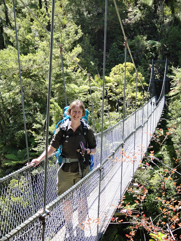
Swing Bridge

There is not a lot of bird song in the forest, but one time I stop for a rest a New Zealand robin comes to visit me. When I was staying in a hostel in Tarkaka I was chatting to a Canadian-German biologist who had just finished working in New Zealand on a project counting these robins. She told me they are totally unrelated to the European robins, but because they look and behave similarly the settlers named them robins. She also told me that New Zealand birds give off a scent, whereas European birds don’t. This wasn’t a problem originally; as New Zealand had no indigenous mammals to prey on them. When the settlers introduced mammals such as rats, stoats and weasels, the birds were easy prey and this is proving to be such a problem today that in some areas mammals are now being systematically trapped or poisoned to try and give the birds a better chance. Her project was also trying to find out the purpose of the scent the birds have.
New Zealand Robin

After the hut the path turns away from the river and climbs steadily for the next 3 hours as it climbs 850 metres. I take it very slowly and the roots of the beech trees are by turns helpful as steps and unhelpful as things to trip over.
Rooty Path

Then the path becomes stony and rocky outcrops loom amongst the trees. I am glad to reach the next hut and rest my legs. This is a larger modern hut, sited just at the bush line and with a view to the Richmond Range of mountains on the opposite side of the river.
Rocks Hut

Mountain View

I am the only one at the hut and I spend a pleasant afternoon reading my book on the veranda. Just as it is getting dark I hear voices approaching and 3 girls arrive who I have met previously in the hostel in Nelson. They have come in the opposite direction from me, so we share descriptions of the walks ahead for each of us, before tucking into our sleeping bags for the night.
The next morning the mountains are hidden in cloud as I set off, but this soon dissipates. Today’s walk goes across an open rocky area with views all around and up to a saddle below Dun Mountain. So much of New Zealand walking is in the bush and it is refreshing to get uninterrupted far-reaching views.
Views from Dun Saddle 32, 36


Dun Mountain was named because of its brown colour, both of the rock it is made of and the vegetation covering it. They even named the rock ‘Dunite’. This is a mineral belt and not much grows here because plants struggle to grow in the mineral-rich ground. The slippery shaley path continues to Coppermine Saddle, named after the settlers’ hope of finding copper here. There proved to be very little of the metal; but they did find chromite, which is a black crystalline chrome iron ore that was used in the manufacture of dyes, in tanning and then later in steel manufacture. In the 1860s 5700 tonnes of the stuff was exported from here to England.
Me at Coppermine Saddle

What is claimed to be New Zealand’s first railway was built up this mountain in order to bring the chromite down. Horses pulled the empty trucks up the track from Nelson to the terminus at Coppermine Saddle and then the full trucks came down with gravity and a brakesman to keep control of the speed. Nowadays the track is for walkers and mountain bikers. I follow the track gradually downhill for 3 ½ hours. To begin with it is open and barren and then as it leaves the mineral belt it descends into bush and the views are lost once more. Along the way occasional original wooden sleepers are still visible as a reminder of the original purpose of the track.
Old Railway Track

The track pops out of the bush on the southern limit of Nelson and I walk back to the hostel, feeling pleased with my achievement.

Thursday, 26 January 2012

Abel Tasman Coast Track

Equipped with new hiking boots and orthotic insoles, my feet and I are now ready to tackle my next tramp. This will be the Abel Tasman Coast Track, which extends an easy 51km along the coast of the national park with the same name; so-called after the Dutch explorer who discovered New Zealand and anchored off this coast in 1642.  This is the most widely used recreational track in New Zealand, because of its stunning beaches and coastal scenery and because it is easily accessible at many points along its length via the water taxis which buzz up and down the coast.  This is no wilderness experience. It is reminiscent of the section of the south-west coast path around the Salcombe estuary, with picnickers, day walkers, kayakers, yachties, jet skiers and hikers all sharing the same coast.
I take a water taxi from Nelson across Tasman Bay into the national park and get dropped off a short way from the start of the track at Coquille Bay, along with 4 young Israelis, who are also tramping. I take a picture for them and they take a picture for me at the start of our walk. There is no-one else on this beautiful beach and as the boat leaves, the noise of the cicadas in the bush at the back of the beach becomes more obvious, until it sounds as if we are in a tropical rainstorm.
The start of my walk

Coquille Bay

The well-formed path goes though the bush along the coast, with the noise of the cicadas for company. They are well-camoflauged brown insects about 5cm long and have translucent wings, which they twitch to make a clicking sound.  To begin with I can't see them at all and then I become aware of them flying in patches of sunlight or out of the corner of my eye as they cross the path in front of me. Sometimes they whistle past my ear and one time one lands on the top of my rucksack and makes a squealing noise that makes be bat at it wildly behind my head.
Every so often there are views that make me think I have just seen the best coastal view of all time – until the next view. There are side paths that cut down the hill to beaches, some of which are deserted and others might have a few kayakers paddling by, or yachts moored in the bay.
Views from the path


After 4 hours I reach Anchorage, which is the busiest beach so far, with water taxis and kayaks landing and leaving. There is a camp ground and hut here and the people off the boats, as well as the kayakers and walkers, mill around, changing out of wet clothes, looking for the toilets and making themselves at home if they are staying overnight. I have a refreshing swim in the sea and watch the comings and goings of the people.
The beach at Anchorage
Anchorage hut

The hut sleeps 24 in two rooms, each with 6 mattresses side-by-side and another 6 above and it will be full tonight. This will be the closest I will have slept to a complete stranger and as I am here early, I bag a mattress against a wall, rather than have someone sleeping on both sides of me. A ‘no smoking’ sign has been changed into ‘no snoring’, presumably in reaction to someone’s uncomfortable night of community sleeping.
No snoring

Gradually the hut fills up. The Israelis arrive, move into my room and speak their strange Hebrew language around me. Fortunately the ‘no snoring’ sign works and we have a peaceful night’s sleep.
The next morning I swim again before breakfast, but this time there is something in the water. Fish have laid spawn overnight and the translucent strings of eggs hang in the water and I can feel them against my skin as I swim. It is slightly off-putting and feels like swimming in soup, so it is a very quick dip.
Morning swim
Today’s walk starts out with a river crossing, so I wait for the tide to drop and for some company before wading across up to my knickers to the path on the other side.
Estuary at low tide

The path winds inland through the bush and for a while the sea views are lost. Then there is a swing bridge to cross a river and a view of its sandy estuary, which looks like a beach enclosed by land, as the mouth is not visible from this angle.
Falls River Estuary at low tide

Swing bridge

The second day’s walk ends at Bark Bay, where the hut is set just back behind the sandbar beach, on the edge of the sandy estuary. As the tide comes in it swirls into shallow pools and fills the space behind the sandbar, right up to the edge of the hut. The turquoise sea against the golden sand and blue sky looks like  just the place where Terry Frost might have got his inspiration for his paintings.
Bark Bay

Boots at the hut

Estuary in the evening
The third day is cloudier and the raincoat gets put on and taken off several times as the track goes up and down through beautiful groves of tree ferns.
Tree Ferns
 
Then I get to a long beach, at the end of which there is another tidal crossing. The Israelis are sitting at a picnic bench waiting for the tide to drop and they ask me if I would like to join them for coffee. I am pleasantly surprised, because although we have shared the path, huts and almost beds, for the last 2 days, we have hardly spoken. But sitting over coffee they are great. They are all travelling after their national service, before returning home to study, which is quite a typical option for young people from their country. Boys have to serve 3 years from 18 years old and the girls two years. Girls don’t have to fight, but if they wish, they can fight within the borders of Israel. None of these 4 saw active service. I ask them how young people feel about having to do national service and they say that it is regarded as a rite of passage.
After the river crossing the path continues though the bush, before giving a view of the Awaroa Inlet where the third hut is sited.
Views of Awaroa Inlet at low tide


Driftwood and agapanthus
As I walk along the side of the estuary towards the hut I can see a procession of people wading across the estuary, coming towards the hut from the opposite direction. At this point the estuary can only be crossed safely within 2 hours either side of low tide. These people arrive at the hut at the same time as me. They are a group of 14 New Zealand friends from the north island, who tramp together a couple of times a year. It happens to be the birthday of one of the ladies and as soon as they have taken off their packs and boots, the birthday paraphernalia appears and party hats are passed around for everyone.
Awaroa Hut

Birthday party
They have also managed to carry a fairly large quality of alcohol and soon they are singing and dancing the hokey cokey in the garden. Additional entertainment comes in the form of 3 Germans, who arrive on our side of the river at about 8pm and are determined to cross the river, even though it is now hours after low tide and far past the advised safe time to cross. They think about it for a while and then decide to go for it. They wade in and are soon up to their waists, before thinking better of it and back-tracking to the beach. Then they decide to try again further upstream and in the fading light we watch them put their packs on their heads and make it across to the other side with the water chest-high. It is just about light enough for us to see that they get across safely and that there is now another person on the far side. Surely he will not also try to cross! But it is now too dark to see.
I sit around the table inside the hut and chat with the Israelis. I would like to know more about them and their country. They talk to me of the beautiful and diverse landscape of their little country; a little about living with conflict and that they can see no solution to the problems. One of them is reading a novel in Hebrew and I take a look at the book to see what the script looks like. I learn that it is printed from right to left on the page and a book starts at what is the back for us.
Israeli friends

Unfortunately there isn’t a ‘no snoring’ sign in this hut and overnight several of the party revellers take full advantage of this opportunity.
In the morning there is a mystery body asleep on the floor of the hut kitchen. This is the hapless Lucas from the Czech Republic, the person we could vaguely make out on the far shore of the river late last night. He looks so sorry for himself and over breakfast he tells us his tale. Having walked for about 10 hours the day before, his plan was to reach our hut for the night. He arrived at the river side and watched the 3 Germans make their crossing in the gloaming, chest-high in the water. They told him there was no problem to make the crossing. Although he was doubtful he gave it a try, but soon realised it was foolish. Now it was completely dark, he didn’t have a torch and was wet through, as well as still on the wrong side of the river. He had no choice but to wait for the tide to drop. The sandflies were all over him, so he got into his sleeping bag, but his zip was broken, so that didn’t help too much. In the dark he was visited by an inquisitive possum (although he didn’t know what type of animal it was). Eventually just as he was getting comfortable, it started to rain. At 3 o’clock in the morning the tide had dropped enough to make the river crossing and then he had to wander up and down the beach looking for the hut in the dark and hoping that he wouldn't blunder into a private house. Finally he found the hut and lay down in the kitchen and had a couple of hours of quality sleep. We are howling with laughter by this time at his story of woe, as the well-planned can laugh indulgently at the disorganised person. Lucas tells us with a rueful smile that this wasn’t the experience he had hoped for in his trip to New Zealand and he just wants his tramp to be over.
The hapless Lucas

The tide is not right for me to cross the river this morning, so I take a walk back around the inlet to the beach to take a water taxi to Totaranui Beach a little further up the coast.
Awaroa Inlet with the tide in

There is an up-market hotel by the beach here, rather like the Hell Bay Hotel sits on Bryher on the Isles of Scilly and I fill the time waiting for my boat with a cappacino and a slice of carrot cake.
Awaroa Lodge Cafe

The next beach at Totaranui is normally accessible by an unsealed road from the north of the park and the large camp ground is usually packed in this main holiday season. However mud slides before Christmas caused a lot of damage in this north part of the park and the road was washed out. The cost of repairing it goes into the millions and it is not clear yet whether it will ever be repaired. So at the moment the only access into and out of the park at the north end is by boat and the camp ground is very quiet.
I have 3 hours here before my next boat to take me out of the park, so walk along the path to the next beach and around a headland with views back down to Totranui Beach.
Anapai Beach

Totaranui Beach

The boat ride north goes through the choppy waters around Separation Point and as we pass Wainui Bay the extent of the mudslides becomes visible as brown lines scratched into the usually green hillsides.
Separation Point

Mud slides on the hills