Equipped with new hiking boots and orthotic insoles, my feet and I are now ready to tackle my next tramp. This will be the Abel Tasman Coast Track, which extends an easy 51km along the coast of the national park with the same name; so-called after the Dutch explorer who discovered New Zealand and anchored off this coast in 1642. This is the most widely used recreational track in New Zealand, because of its stunning beaches and coastal scenery and because it is easily accessible at many points along its length via the water taxis which buzz up and down the coast. This is no wilderness experience. It is reminiscent of the section of the south-west coast path around the Salcombe estuary, with picnickers, day walkers, kayakers, yachties, jet skiers and hikers all sharing the same coast.
I take a water taxi from Nelson across Tasman Bay into the national park and get dropped off a short way from the start of the track at Coquille Bay, along with 4 young Israelis, who are also tramping. I take a picture for them and they take a picture for me at the start of our walk. There is no-one else on this beautiful beach and as the boat leaves, the noise of the cicadas in the bush at the back of the beach becomes more obvious, until it sounds as if we are in a tropical rainstorm.
The start of my walk

Coquille Bay

The well-formed path goes though the bush along the coast, with the noise of the cicadas for company. They are well-camoflauged brown insects about 5cm long and have translucent wings, which they twitch to make a clicking sound. To begin with I can't see them at all and then I become aware of them flying in patches of sunlight or out of the corner of my eye as they cross the path in front of me. Sometimes they whistle past my ear and one time one lands on the top of my rucksack and makes a squealing noise that makes be bat at it wildly behind my head.
Every so often there are views that make me think I have just seen the best coastal view of all time – until the next view. There are side paths that cut down the hill to beaches, some of which are deserted and others might have a few kayakers paddling by, or yachts moored in the bay.
Views from the path


After 4 hours I reach Anchorage, which is the busiest beach so far, with water taxis and kayaks landing and leaving. There is a camp ground and hut here and the people off the boats, as well as the kayakers and walkers, mill around, changing out of wet clothes, looking for the toilets and making themselves at home if they are staying overnight. I have a refreshing swim in the sea and watch the comings and goings of the people.
The beach at Anchorage

Anchorage hut

The hut sleeps 24 in two rooms, each with 6 mattresses side-by-side and another 6 above and it will be full tonight. This will be the closest I will have slept to a complete stranger and as I am here early, I bag a mattress against a wall, rather than have someone sleeping on both sides of me. A ‘no smoking’ sign has been changed into ‘no snoring’, presumably in reaction to someone’s uncomfortable night of community sleeping.
No snoring


Gradually the hut fills up. The Israelis arrive, move into my room and speak their strange Hebrew language around me. Fortunately the ‘no snoring’ sign works and we have a peaceful night’s sleep.
The next morning I swim again before breakfast, but this time there is something in the water. Fish have laid spawn overnight and the translucent strings of eggs hang in the water and I can feel them against my skin as I swim. It is slightly off-putting and feels like swimming in soup, so it is a very quick dip.
Morning swim


Today’s walk starts out with a river crossing, so I wait for the tide to drop and for some company before wading across up to my knickers to the path on the other side.
Estuary at low tide

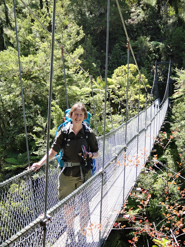
The path winds inland through the bush and for a while the sea views are lost. Then there is a swing bridge to cross a river and a view of its sandy estuary, which looks like a beach enclosed by land, as the mouth is not visible from this angle.
Falls River Estuary at low tide

Swing bridge
The second day’s walk ends at Bark Bay, where the hut is set just back behind the sandbar beach, on the edge of the sandy estuary. As the tide comes in it swirls into shallow pools and fills the space behind the sandbar, right up to the edge of the hut. The turquoise sea against the golden sand and blue sky looks like just the place where Terry Frost might have got his inspiration for his paintings.
Bark Bay


Boots at the hut


Estuary in the evening


The third day is cloudier and the raincoat gets put on and taken off several times as the track goes up and down through beautiful groves of tree ferns.
 Then I get to a long beach, at the end of which there is another tidal crossing. The Israelis are sitting at a picnic bench waiting for the tide to drop and they ask me if I would like to join them for coffee. I am pleasantly surprised, because although we have shared the path, huts and almost beds, for the last 2 days, we have hardly spoken. But sitting over coffee they are great. They are all travelling after their national service, before returning home to study, which is quite a typical option for young people from their country. Boys have to serve 3 years from 18 years old and the girls two years. Girls don’t have to fight, but if they wish, they can fight within the borders of Israel. None of these 4 saw active service. I ask them how young people feel about having to do national service and they say that it is regarded as a rite of passage.
Tree Ferns

After the river crossing the path continues though the bush, before giving a view of the Awaroa Inlet where the third hut is sited.
Views of Awaroa Inlet at low tide


Driftwood and agapanthus


As I walk along the side of the estuary towards the hut I can see a procession of people wading across the estuary, coming towards the hut from the opposite direction. At this point the estuary can only be crossed safely within 2 hours either side of low tide. These people arrive at the hut at the same time as me. They are a group of 14 New Zealand friends from the north island, who tramp together a couple of times a year. It happens to be the birthday of one of the ladies and as soon as they have taken off their packs and boots, the birthday paraphernalia appears and party hats are passed around for everyone.
Awaroa Hut


Birthday party


They have also managed to carry a fairly large quality of alcohol and soon they are singing and dancing the hokey cokey in the garden. Additional entertainment comes in the form of 3 Germans, who arrive on our side of the river at about 8pm and are determined to cross the river, even though it is now hours after low tide and far past the advised safe time to cross. They think about it for a while and then decide to go for it. They wade in and are soon up to their waists, before thinking better of it and back-tracking to the beach. Then they decide to try again further upstream and in the fading light we watch them put their packs on their heads and make it across to the other side with the water chest-high. It is just about light enough for us to see that they get across safely and that there is now another person on the far side. Surely he will not also try to cross! But it is now too dark to see.
I sit around the table inside the hut and chat with the Israelis. I would like to know more about them and their country. They talk to me of the beautiful and diverse landscape of their little country; a little about living with conflict and that they can see no solution to the problems. One of them is reading a novel in Hebrew and I take a look at the book to see what the script looks like. I learn that it is printed from right to left on the page and a book starts at what is the back for us.
Israeli friends

Unfortunately there isn’t a ‘no snoring’ sign in this hut and overnight several of the party revellers take full advantage of this opportunity.
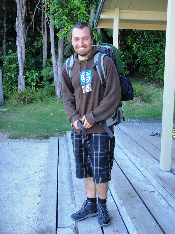
In the morning there is a mystery body asleep on the floor of the hut kitchen. This is the hapless Lucas from the Czech Republic, the person we could vaguely make out on the far shore of the river late last night. He looks so sorry for himself and over breakfast he tells us his tale. Having walked for about 10 hours the day before, his plan was to reach our hut for the night. He arrived at the river side and watched the 3 Germans make their crossing in the gloaming, chest-high in the water. They told him there was no problem to make the crossing. Although he was doubtful he gave it a try, but soon realised it was foolish. Now it was completely dark, he didn’t have a torch and was wet through, as well as still on the wrong side of the river. He had no choice but to wait for the tide to drop. The sandflies were all over him, so he got into his sleeping bag, but his zip was broken, so that didn’t help too much. In the dark he was visited by an inquisitive possum (although he didn’t know what type of animal it was). Eventually just as he was getting comfortable, it started to rain. At 3 o’clock in the morning the tide had dropped enough to make the river crossing and then he had to wander up and down the beach looking for the hut in the dark and hoping that he wouldn't blunder into a private house. Finally he found the hut and lay down in the kitchen and had a couple of hours of quality sleep. We are howling with laughter by this time at his story of woe, as the well-planned can laugh indulgently at the disorganised person. Lucas tells us with a rueful smile that this wasn’t the experience he had hoped for in his trip to New Zealand and he just wants his tramp to be over.
The hapless Lucas

The tide is not right for me to cross the river this morning, so I take a walk back around the inlet to the beach to take a water taxi to Totaranui Beach a little further up the coast.
Awaroa Inlet with the tide in

There is an up-market hotel by the beach here, rather like the Hell Bay Hotel sits on Bryher on the Isles of Scilly and I fill the time waiting for my boat with a cappacino and a slice of carrot cake.
Awaroa Lodge Cafe

The next beach at Totaranui is normally accessible by an unsealed road from the north of the park and the large camp ground is usually packed in this main holiday season. However mud slides before Christmas caused a lot of damage in this north part of the park and the road was washed out. The cost of repairing it goes into the millions and it is not clear yet whether it will ever be repaired. So at the moment the only access into and out of the park at the north end is by boat and the camp ground is very quiet.
I have 3 hours here before my next boat to take me out of the park, so walk along the path to the next beach and around a headland with views back down to Totranui Beach.
Anapai Beach


Totaranui Beach


The boat ride north goes through the choppy waters around Separation Point and as we pass Wainui Bay the extent of the mudslides becomes visible as brown lines scratched into the usually green hillsides.
Separation Point


Mud slides on the hills


2 comments:
Hi Helly what beautiful beaches and views.
had alot of rain here but brighter today and summer isn;t too far away.
take care and stay clear off the hapless Lucas!!
L&O's Hatty x
another beautiful beach another beautiful beach another beautiful beach
Post a Comment